usmtf::Geoline Class Reference
#include <Geoline.hpp>
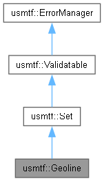
Inheritance diagram for usmtf::Geoline:
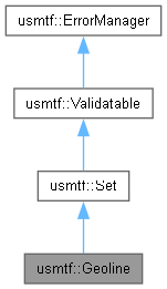
Collaboration diagram for usmtf::Geoline:
Public Member Functions | |
| Geoline (const std::string &aSTF, const std::vector< Field > &aFields) noexcept | |
| const std::vector< LatLon > & | GetPoints () const noexcept |
| Public Member Functions inherited from usmtf::Set | |
| Set (const std::string &aSTF, const std::vector< Field > &aFields) noexcept | |
| virtual | ~Set ()=default |
| const std::string & | GetType () const noexcept |
| Return the Set Identifiers/Set Text Format of the set instance. | |
| bool | IsEmpty () const noexcept |
| int | GetFieldCount () const noexcept |
| const Field & | GetField (size_t aIndex) const |
| Returns a field at a index position in the Set. | |
| const std::string & | GetFieldContent (size_t aIndex) const |
| Returns the Contents of a field at specified index. | |
| const std::string | GetReconstructedSet () const noexcept |
| Public Member Functions inherited from usmtf::Validatable | |
| bool | IsValid () const noexcept |
| Public Member Functions inherited from usmtf::ErrorManager | |
| virtual | ~ErrorManager ()=default |
| bool | HasErrors () const noexcept |
| void | LogErrors (std::ostream &aOut) const noexcept |
| const std::vector< ValidationError > & | GetErrors () const |
Additional Inherited Members | |
| Protected Member Functions inherited from usmtf::ErrorManager | |
| void | AddError (const ValidationError &aError) noexcept |
| void | AddError (const std::string &aFailureReason, const std::string &aValueValidatied, const std::string &aOptionalSuggestion="") noexcept |
| void | AddError (const std::string &aErrorMessage) noexcept |
| void | AddErrors (const std::vector< ValidationError > &aErrors) noexcept |
| void | ClearErrors () noexcept |
| Protected Attributes inherited from usmtf::Set | |
| std::string | mSetTextFormat |
| std::vector< Field > | mFields |
Detailed Description
The Geoline Set is used to outline the positional details of a volume space that is shaped like a "line". The volumetric aspects are implied to be 1 meter width, height will be determined by efflevel association.
\ / _________/
Note on line complexity: The points define the center mid point of each polygon volume, with the implied width we calculate the corners.
USMTF Example: GEOLINE/LATM:1510N05901E/LATS:153632N0594256E/LATS:155000N0594815E/LATS:155000N0591343E//
Standard Excerpt: GEOLINE / R // 1 POSITION OR POINT
Detailed Document: GEOLINE.UF.HTML
Constructor & Destructor Documentation
◆ Geoline()
|
noexcept |
References usmtf::ErrorManager::AddError(), and usmtf::Set::Set().
Member Function Documentation
◆ GetPoints()
|
noexcept |
The documentation for this class was generated from the following files: